

Ahora estás siguiendo a
Error al seguir a usuario.
Este usuario no permite que los usuarios lo sigan.
Ya estás siguiendo a este usuario.
Tu plan de membresía solo permite 0 seguimientos. Mejora tu membresía aquí.
Dejaste de seguir correctamente a
Error al dejar de seguir al usuario.
Has recomendado exitosamente a
Error al recomendar al usuario.
Algo salió mal. Por favor, actualiza la página e intenta de nuevo.
Email verificado correctamente.

sfantu-gheorghe,
romania
Aquí son las 6:38 a. m.
Se unió el septiembre 15, 2012
0
recomendaciones
Arnold T.
@marcale
3,0
3,0
100%
100%
sfantu-gheorghe,
romania
100 %
Trabajos finalizados
48 %
Dentro del presupuesto
100 %
A tiempo
50 %
Tasa de recontratación
GIS Analyst, Cartograph, Topograph, Civil Engineer
Contacta Arnold T. sobre tu trabajo
Inicia sesión para comentar cualquier detalle por chat.
Portafolio
Portafolio
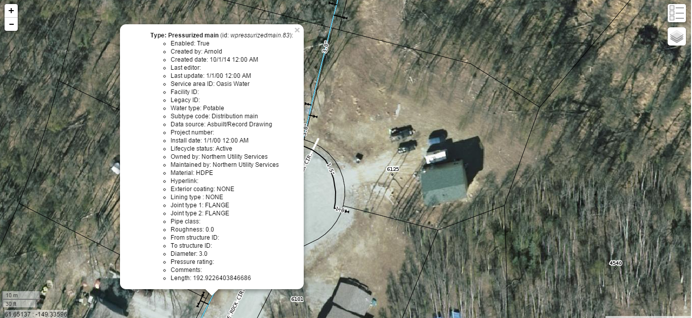

Water Utility GIS

Water Utility GIS

Water Utility GIS
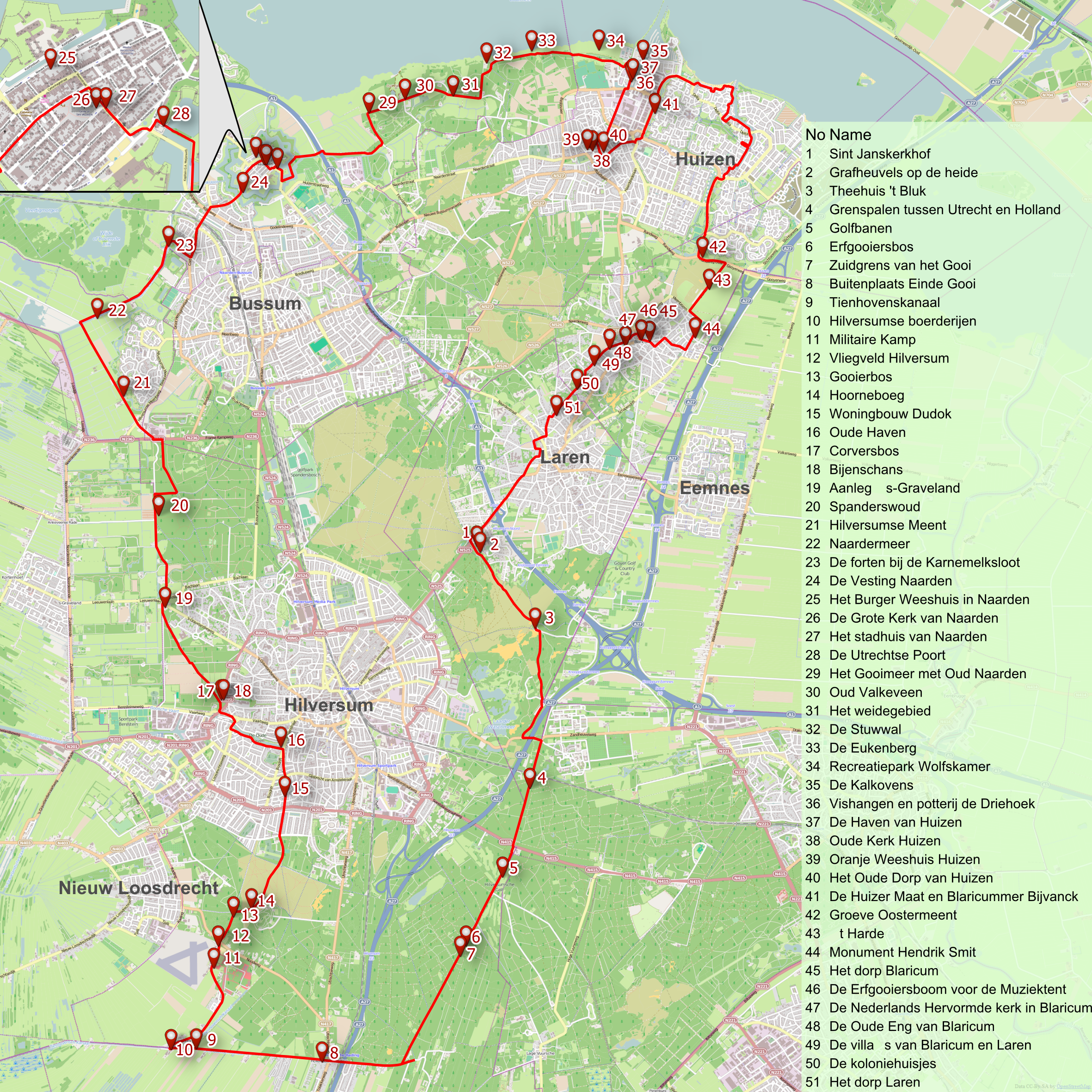

Bicycle tour map
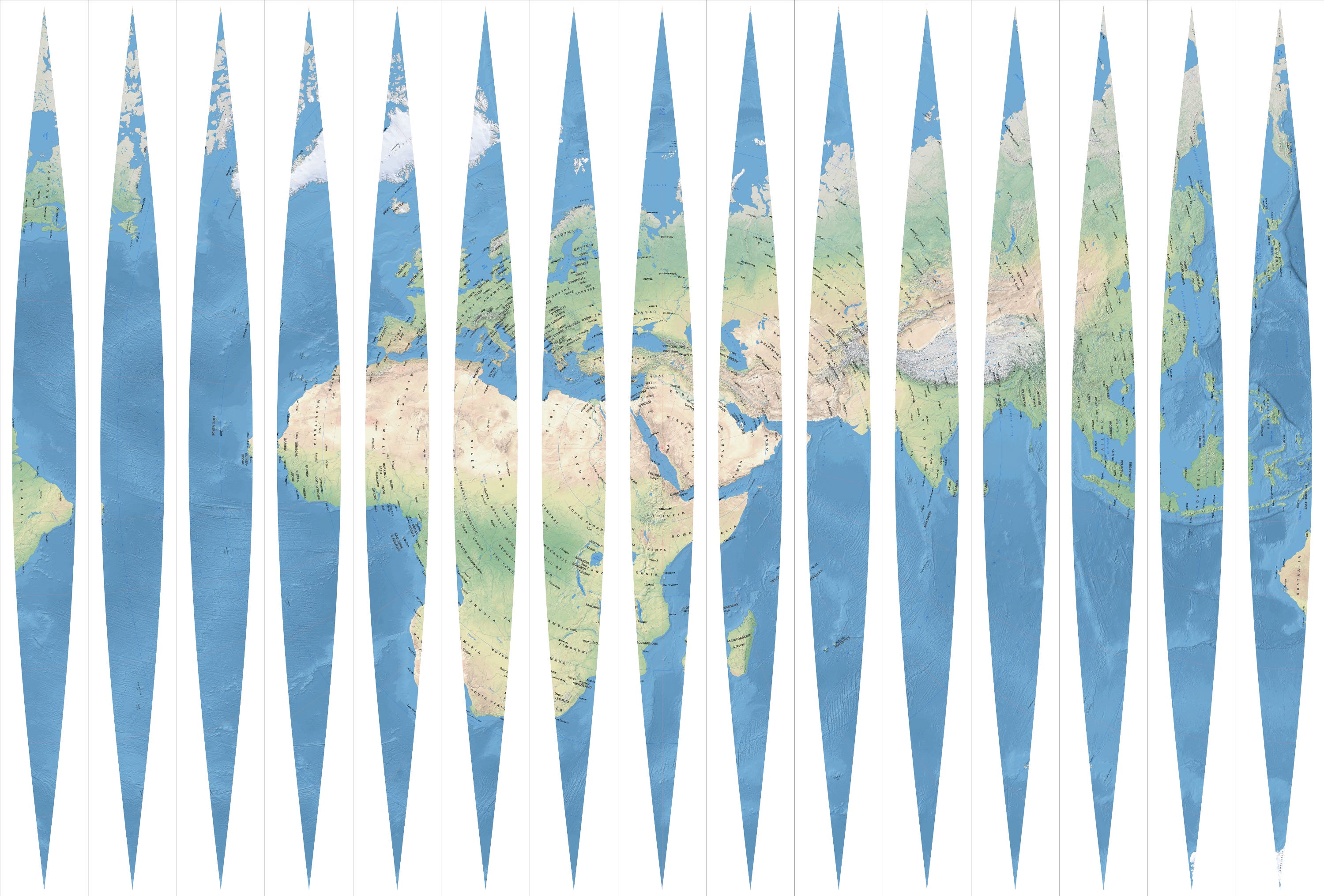

Qibla globe

Qibla globe

Qibla globe
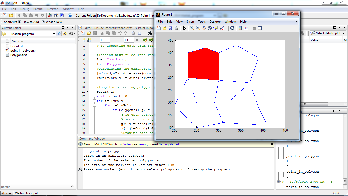

Area calculation of polygons
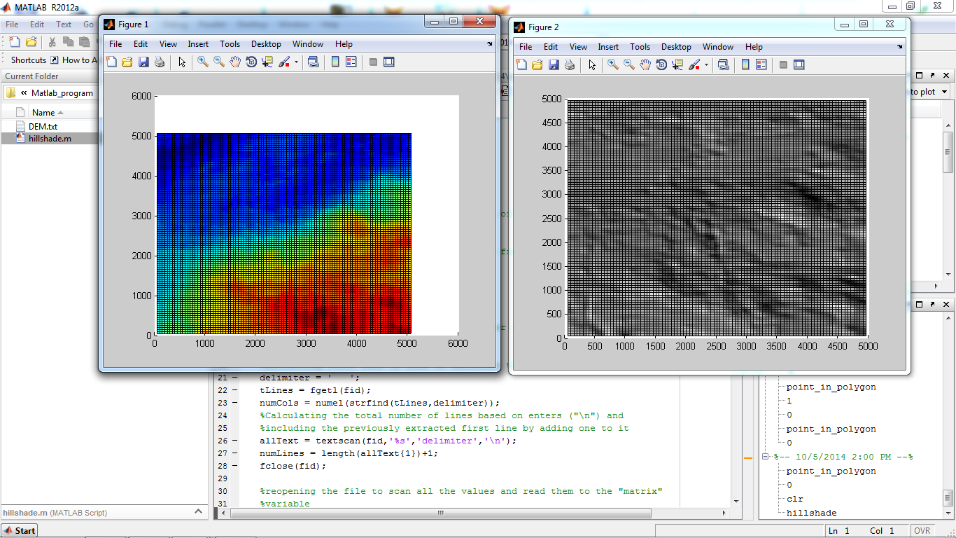

Hillshade calculation of terrain in Matlab
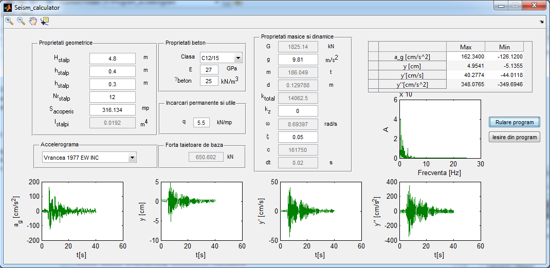

Seismic response calculator
Water Utility GIS
Water Utility GIS
Water Utility GIS
Bicycle tour map
Qibla globe
Qibla globe
Qibla globe
Area calculation of polygons
Hillshade calculation of terrain in Matlab
Seismic response calculator
Comentarios
Cambios guardados
Mostrando 1 - 5 de 5 reseñas
$167,16 USD
Data Processing
Geospatial

•
€30,00 EUR
Geospatial

•
€32,00 EUR
•
¥3.000 JPY
Data Entry
Cartography & Maps
P

•
€66,00 EUR
CAD/CAM
Cartography & Maps
AutoCAD
Geospatial
•
Experiencia
GIS Analyst
may 2015 - Presente
PostgreSQL database maintenance and scripting, Web Mapping. Software developement using .NET (C#), JavaScript, SQL (PostgreSQL, T-SQL).
GIS Analyst
jun 2012 - may 2015 (2 años, 11 meses)
Database maintenance, scripting, geocoding, web-mapping, digitizing
Topography practice
jun 2009 - jul 2009 (1 mes, 1 día)
Topographic and cadastral works.
Educación
Civil Engineer
(4 años)
Masters degree in Geomatics
(2 años)
Cartography
(3 años)
Calificaciones
1st Prize at Geomarketing Contest
Micro Mapper Srl.
2011
Subject of my project: the ideal placement of firms based on the density of the population, the importance of the street network and areas which are concentrating the population (bus station, plaza etc).
Caver certificate
CSA Cluj-Napoca
2008
Certificate conferred by the Amateur Caver Club of Cluj-Napoca proofing: cave cartography, industrial alpinism, first aid, and general cave knowledge skills.
Geospatial workshop participation
geo-spatial.org community
2012
5 certificates for participating at geospatial workshops and seminars: QGIS, Open Layers, SagaGIS, LeoWorks, Tile Cache, R-language, WEBGIS, VTP, gvSIG,
Publicaciones
Volume calculations with ArcGIS
Techical University of Cluj-Napoca
This work is demonstrating the applicability of Geographical Information Systems (GIS) in engineering works, such as calculating the volume of material in embankments, landslides, quarries and amount of water in lakes. In the project are analyzed different methods for calculating volumes using ArcGIS 10. Besides the available software tools, an own calculation method is tried.
Contacta Arnold T. sobre tu trabajo
Inicia sesión para comentar cualquier detalle por chat.
Verificaciones
Certificaciones
Principales habilidades
Explorar freelancers similares
Explorar galerías similares
¡Invitación enviada correctamente!
¡Gracias! Te hemos enviado un enlace para reclamar tu crédito gratuito.
Algo salió mal al enviar tu correo electrónico. Por favor, intenta de nuevo.
Falló el copiado al portapapeles. Intenta de nuevo después de ajustar tus permisos.
Copiado al portapapeles.
Cargando visualización previa
Permiso concedido para Geolocalización.
Tu sesión de acceso ha expirado y has sido desconectado. Por favor, inica sesión nuevamente.